
SHORT RANGE weather FORECAST
| Product name | Short name | Description | Time period | Download |
|---|---|---|---|---|
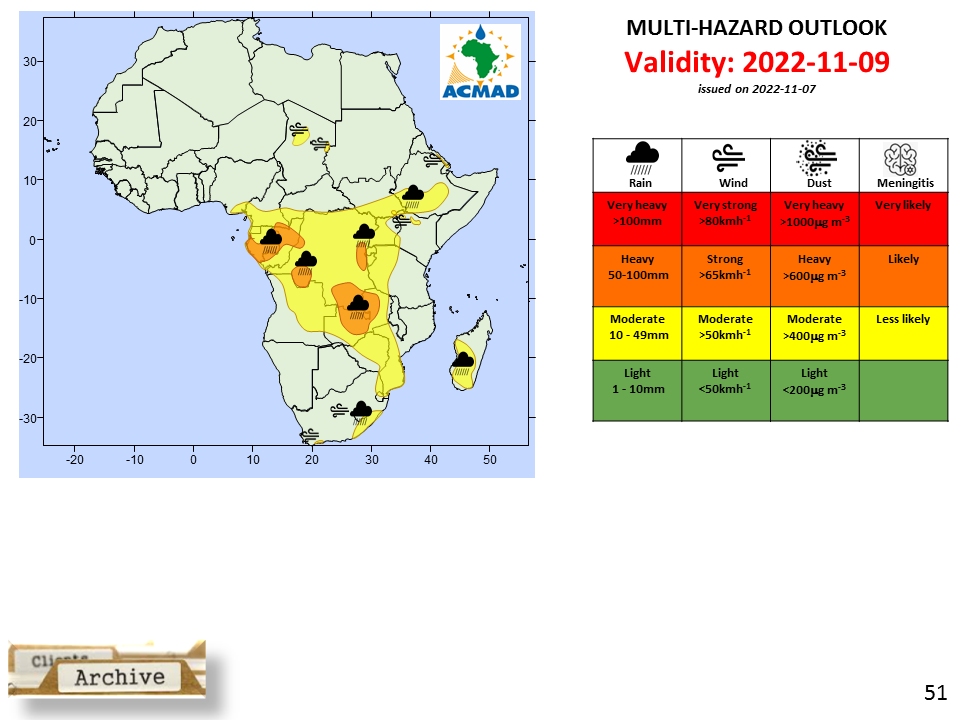
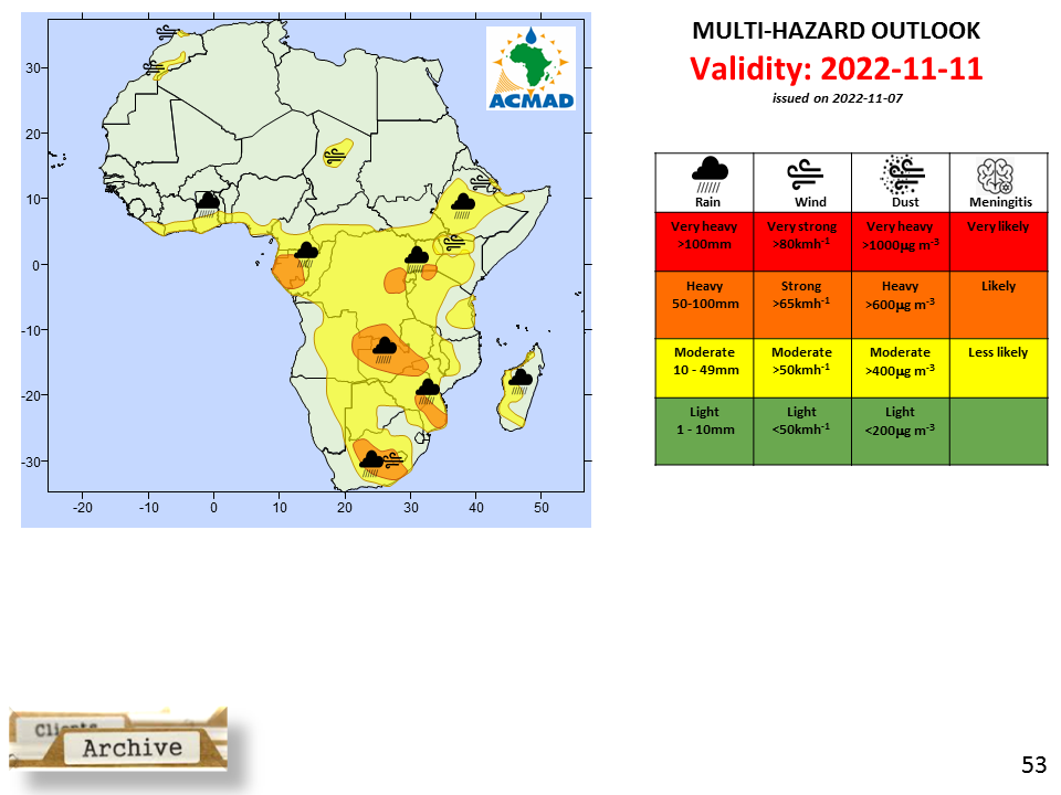
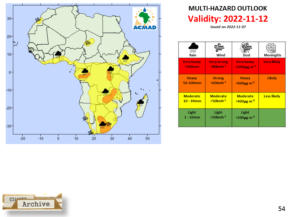
MULTI-HAZARD OUTLOOK D+1 | PNG CSV Geojson | |||
MULTI-HAZARD OUTLOOK D+2 | PNG CSV Geojson | |||
MULTI-HAZARD OUTLOOK D+3 | PNG CSV Geojson | |||
MULTI-HAZARD OUTLOOK D+4 | PNG CSV Geojson | |||
MULTI-HAZARD OUTLOOK D+5 | PNG CSV Geojson | |||
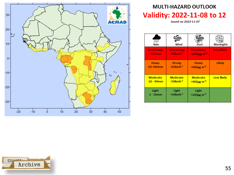
5 days accumulated rainfall | PNG CSV Geojson | |||
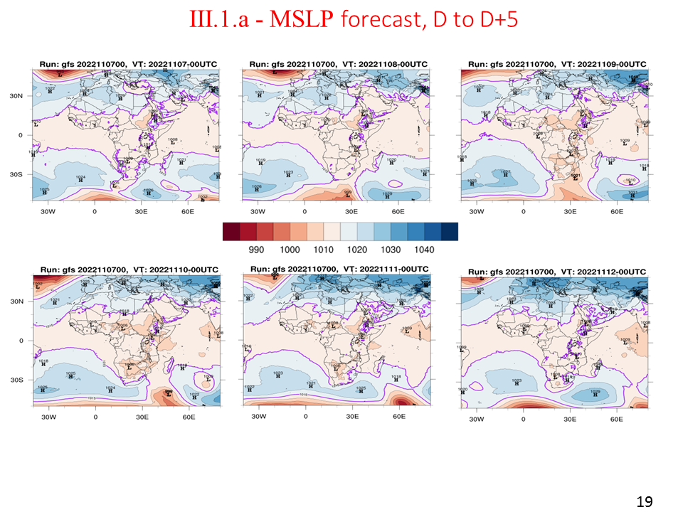
MSLP forecast, D+1 to D+5 | MSLP D+1 to D+5 | PNG CSV Geojson | ||
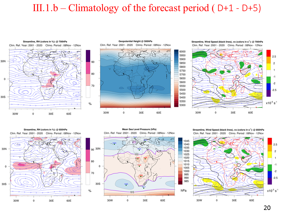
Climatology of the forecast period, D+1 to D+5 | PNG CSV Geojson | |||
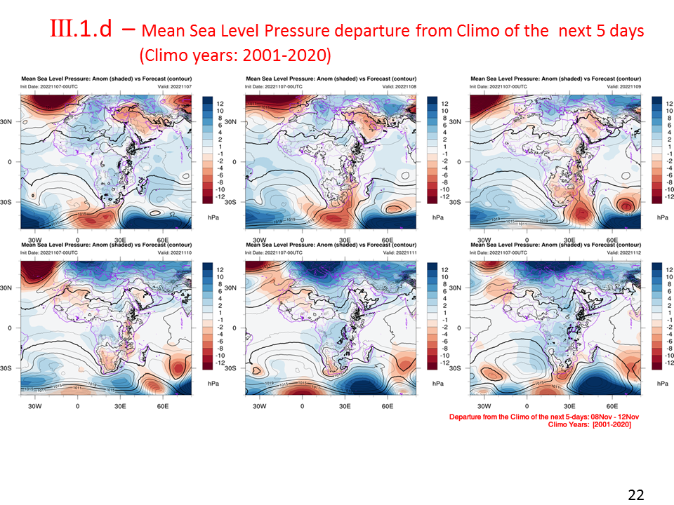
MSLP departure from climo of the next 5 days | PNG CSV Geojson | |||
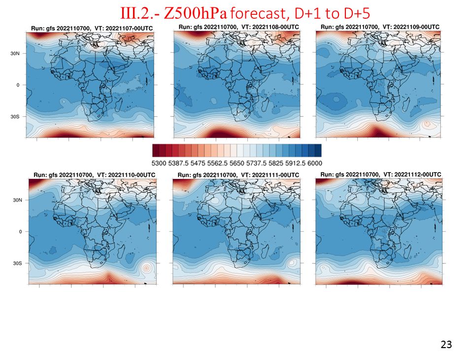
Z500hPa forecast | PNG CSV Geojson | |||
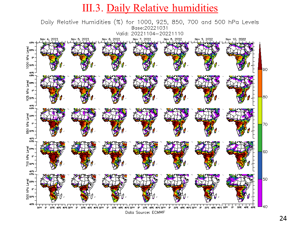
Daily relative humidities for 1000, 925, 850, 700 and 500hPa | PNG CSV Geojson | |||
925hPa Wind and humidity | PNG CSV Geojson | |||
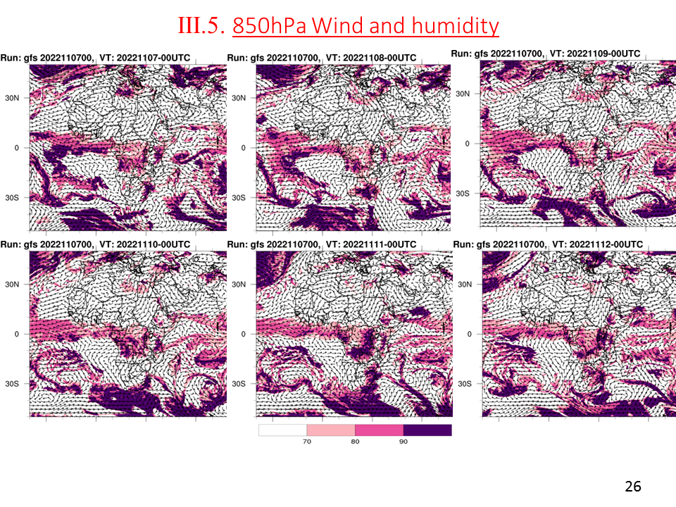
850hPa Wind and humidity | PNG CSV Geojson | |||
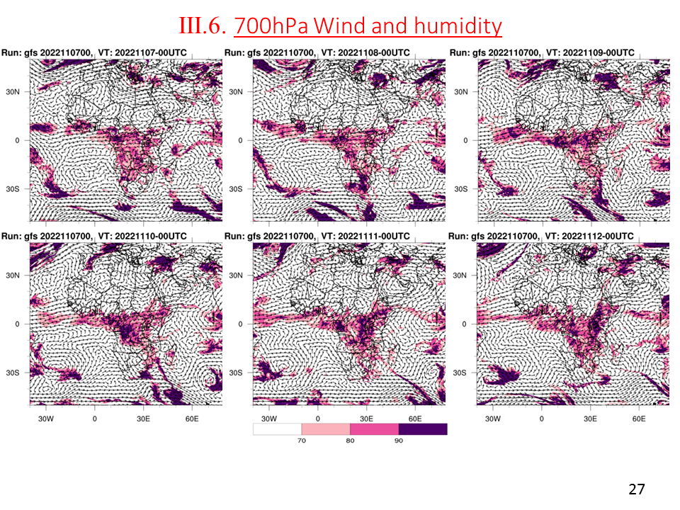
700hPa Wind and humidity | PNG CSV Geojson | |||
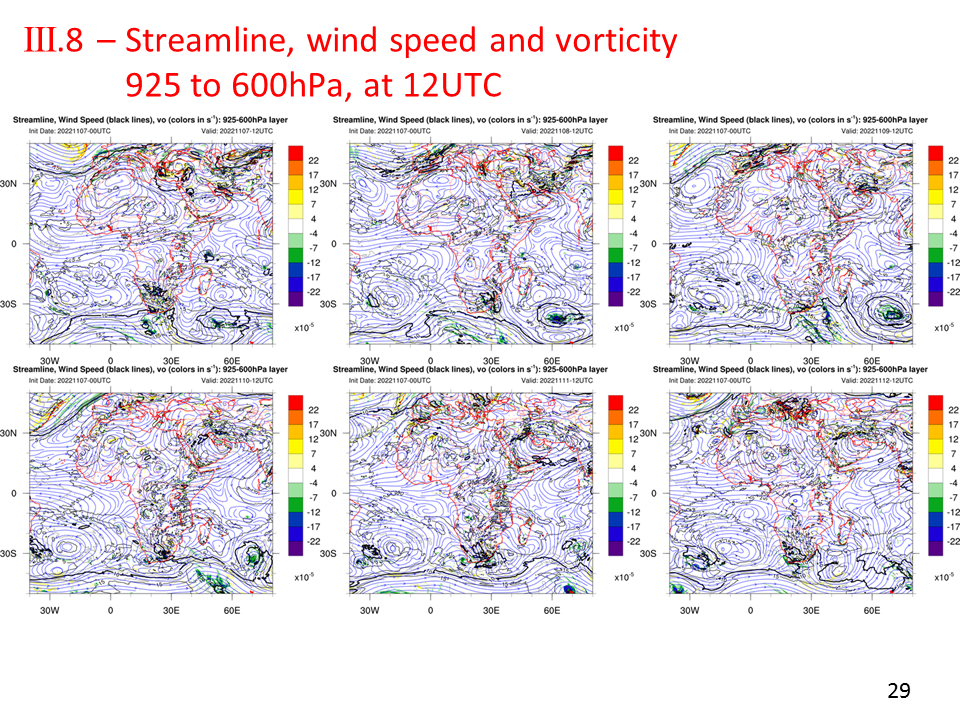
Streamline and vorticity, daily mean (925 to 600hPa) at 12UTC | PNG CSV Geojson | |||
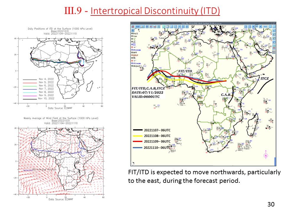
Intertropical Discontinuity (ITD) | PNG CSV Geojson | |||
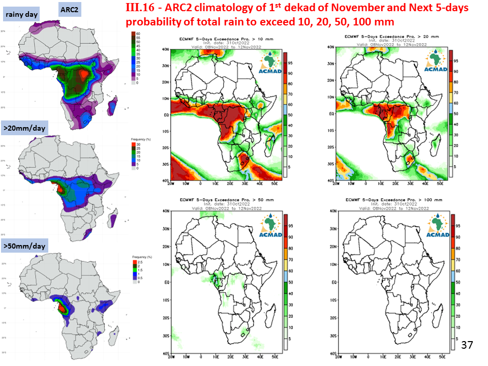
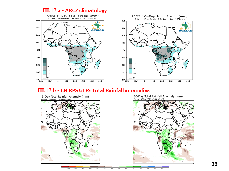
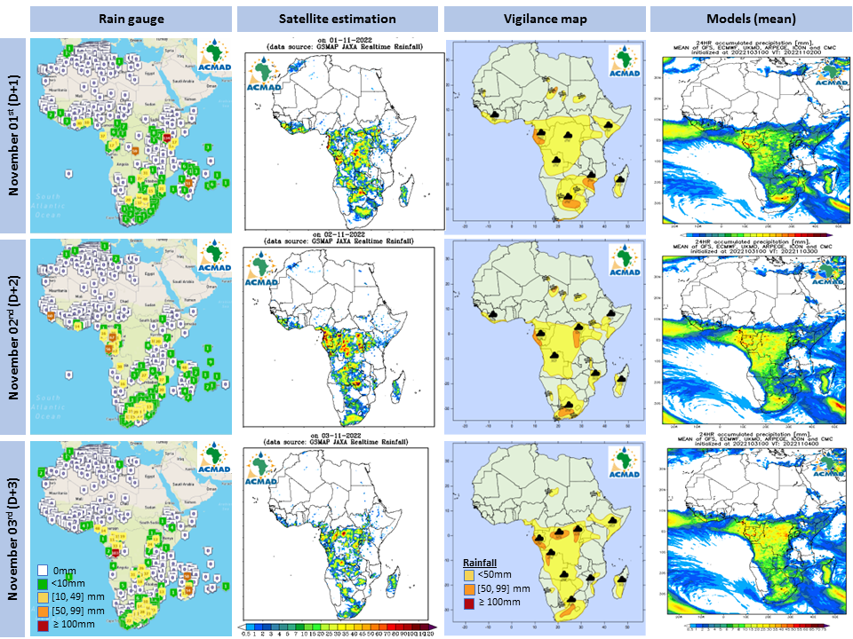
ARC2 climatology of the dekad and the next 5-day probability of total rain to exceed 10, 20, 50, 100 mm | PNG CSV Geojson | |||
Rapid developing thunderstorm at 14UTC, November, 07th, 2022 | PNG CSV Geojson | |||
CHIRPS GEFS Total Rainfall anomalies | PNG CSV Geojson | |||
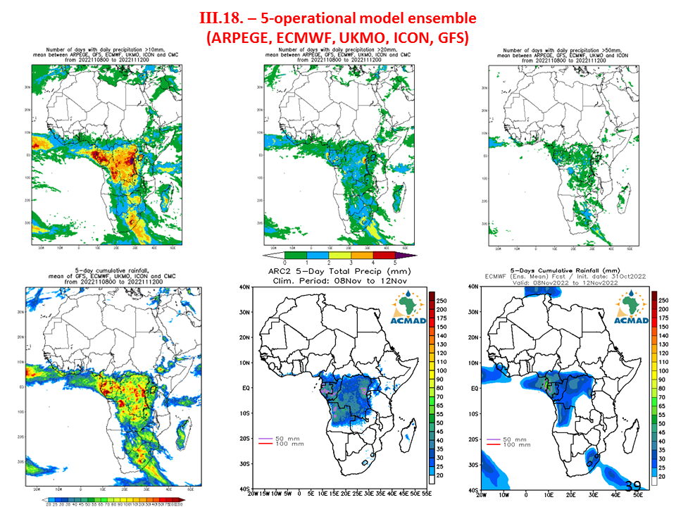
operational model ensemble | PNG CSV Geojson | |||
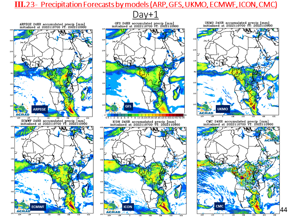
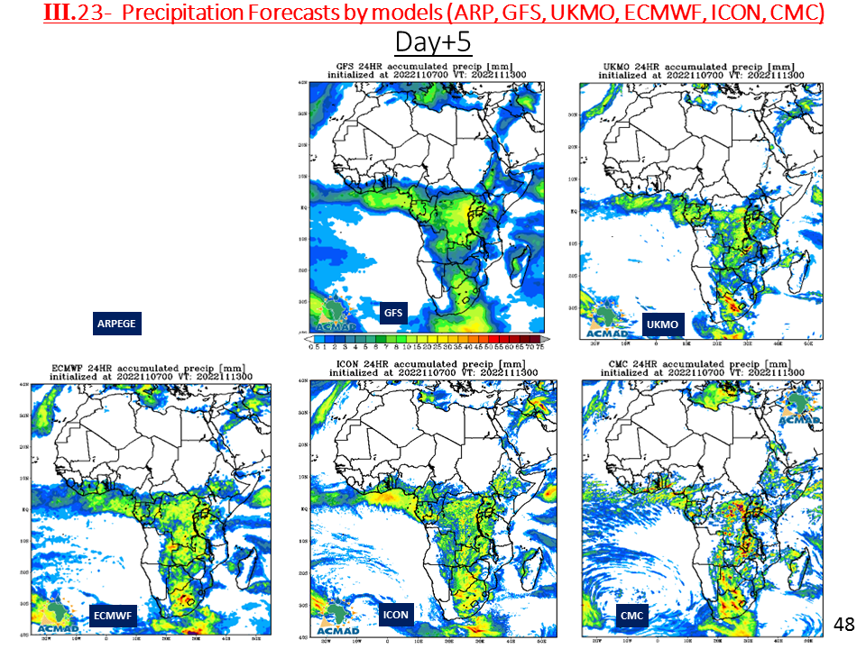
Precipitation Forecasts by models (ARP, GFS, UKMO, ECMWF, ICON, CMC) | PNG CSV Geojson | |||
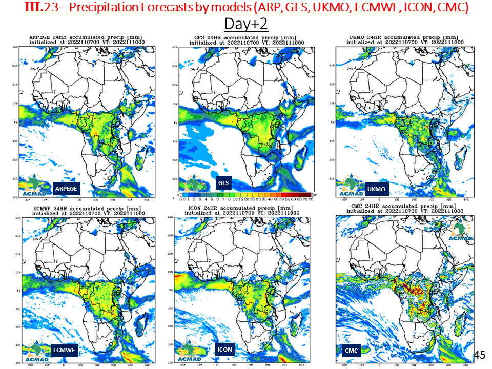
Precipitation Forecasts by models (ARP, GFS, UKMO, ECMWF, ICON, CMC) | PNG CSV Geojson | |||
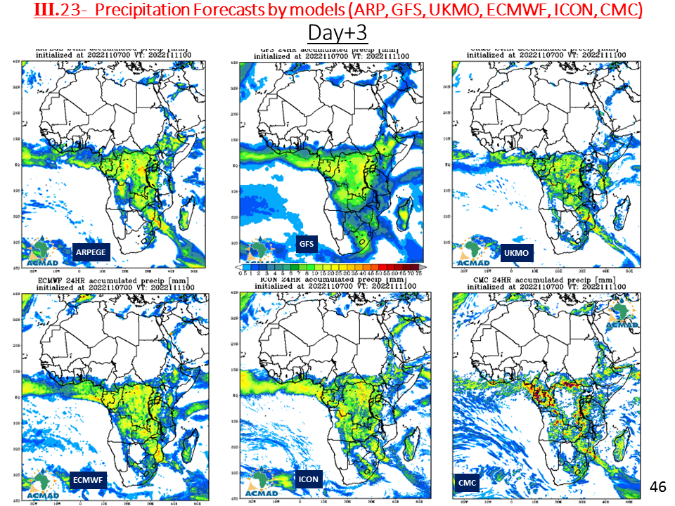
Precipitation Forecasts by models (ARP, GFS, UKMO, ECMWF, ICON, CMC) | PNG CSV Geojson | |||
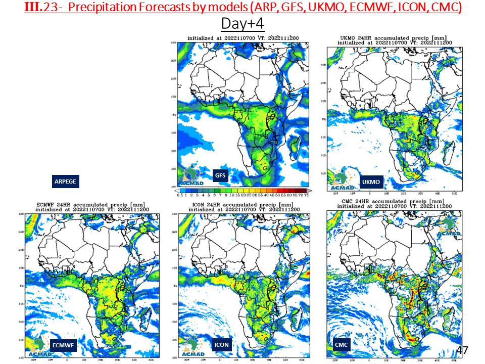
Precipitation Forecasts by models (ARP, GFS, UKMO, ECMWF, ICON, CMC) | PNG CSV Geojson | |||
Precipitation Forecasts by models (ARP, GFS, UKMO, ECMWF, ICON, CMC) | PNG CSV Geojson | |||
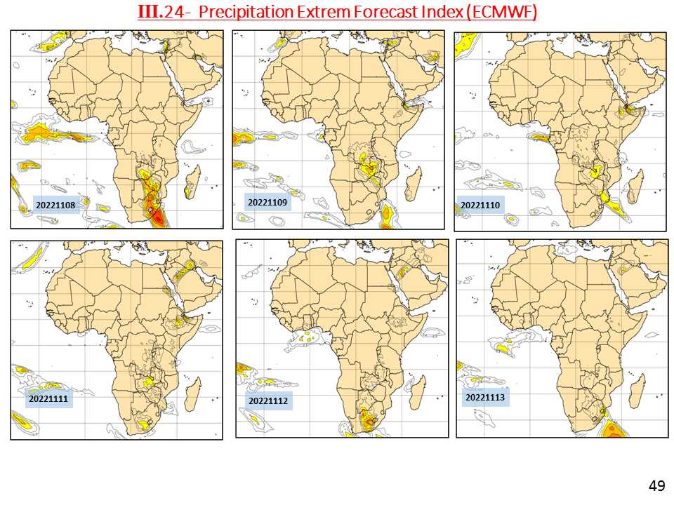
Precipitation Extrem Forecast Index (ECMWF) | PNG CSV Geojson | |||
Verification of past D-1 D-2 and D-3 forecasts for large scales | Ver D-1,D-2,D3 | PNG CSV Geojson |